 |
 |
Home > Offers to Sell > Business Services & Service Equipment > Other Business Services
| Contact: | Frank Zhao |
|---|---|
| Company: | Feiyan Aerial Remote Sensing Tech Co., Ltd. |
| 450 S Taiping Rd Siya Fortune Ctr, 8th Floor | |
| Nanjing 210008 | |
| China | |
| E-Mail: | |
| Date/Time: | 10/25/22 2:57 GMT |
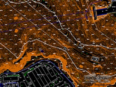
DLGs Topographic Mapping
DLGs Topographic Mapping Supplier - Feiyan Technology
Sensor: DMC II-230
Flight platform: Cessna 208B
Height: 2300m
Resolution: 0.2m
Project area: 8,500km²
Duration: 4 days
Output: DEM, orthophoto or video version
A topographic map is a type of map with a detailed representation of
surface. The topographic map depicts ground relief (landforms and terrain),
drainage (lakes and rivers), forest cover, transportation routes and
facilities, governmental borders, populated areas and man-made objects.
SOURCE: Import-Export Bulletin Board (https://www.imexbb.com/)
Similar Products:Not exactly what you are looking for? Post an Offer to Buy!
![]()
© 1996-2010 IMEXBB.com. All rights reserved.
|
|
|


